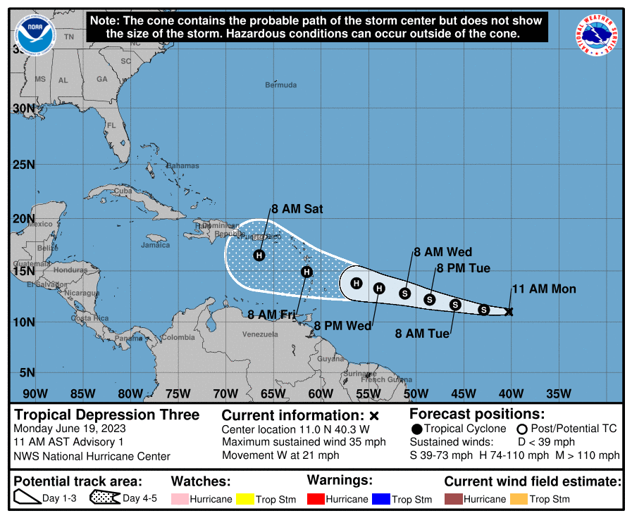
On Monday morning, my regular check of the upcoming weather was anything but routine. Usually, I glance at it for a second and continue with my day. This time, the forecast wasn’t good. Despite being in June, the conditions appeared right for a storm, or even a hurricane, to develop. This Invest 92L system would grow into Tropical Storm Bret. I knew I couldn’t procrastinate or rationalise this away, so I decided to run. The rotation of a TRS is counterclockwise, and it travels in a westward or north-westward direction. This means that the northern leading quadrant has the strongest winds. This, coupled with the fact that due to the Coriolis effect, the storms don’t go south, means that if you do run, you do so to the south.

Passages
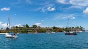
Because of the genoa clew problem, I knew I’d be slow. Losing one of two sails means a loss of speed of over 50%, as the two sails are designed to augment each other. My destination was Grenada, and instead of one long offshore passage, I did it in 2 overnight hops. The first jump was to St. Lucia, the second passage to St. Vincent, and the final hop brought me into Carriacou in Grenada.
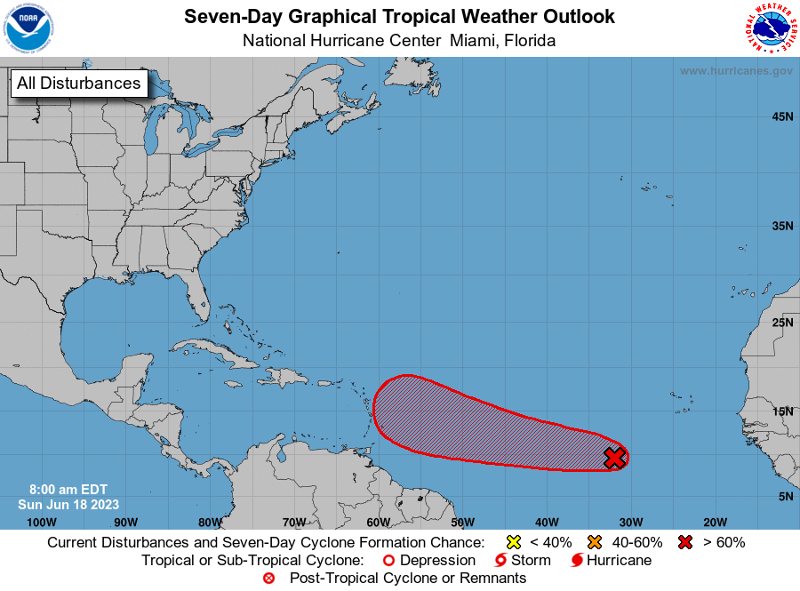
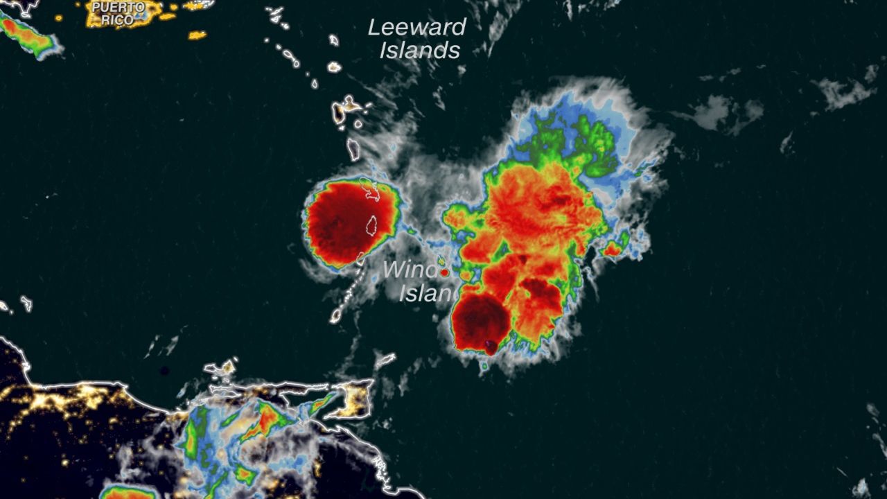
I use 2 main weather models for the Caribbean – the GFS and the ECMWF. For this storm, still just called Invest 92L, they differed very significantly. The two models diverged quite a bit from each other even as the storm system passed onward through the Caribbean. As I headed south, the projected storm path did as well. The first forecast was for the centre to pass over Martinique. Then it was to pass over St. Lucia. And when Tropical Storm Bret finally came through, the centre was between St. Lucia and St. Vincent.
Arrival and storm
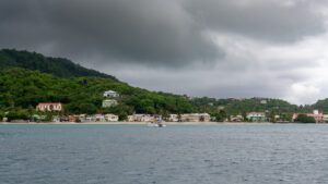
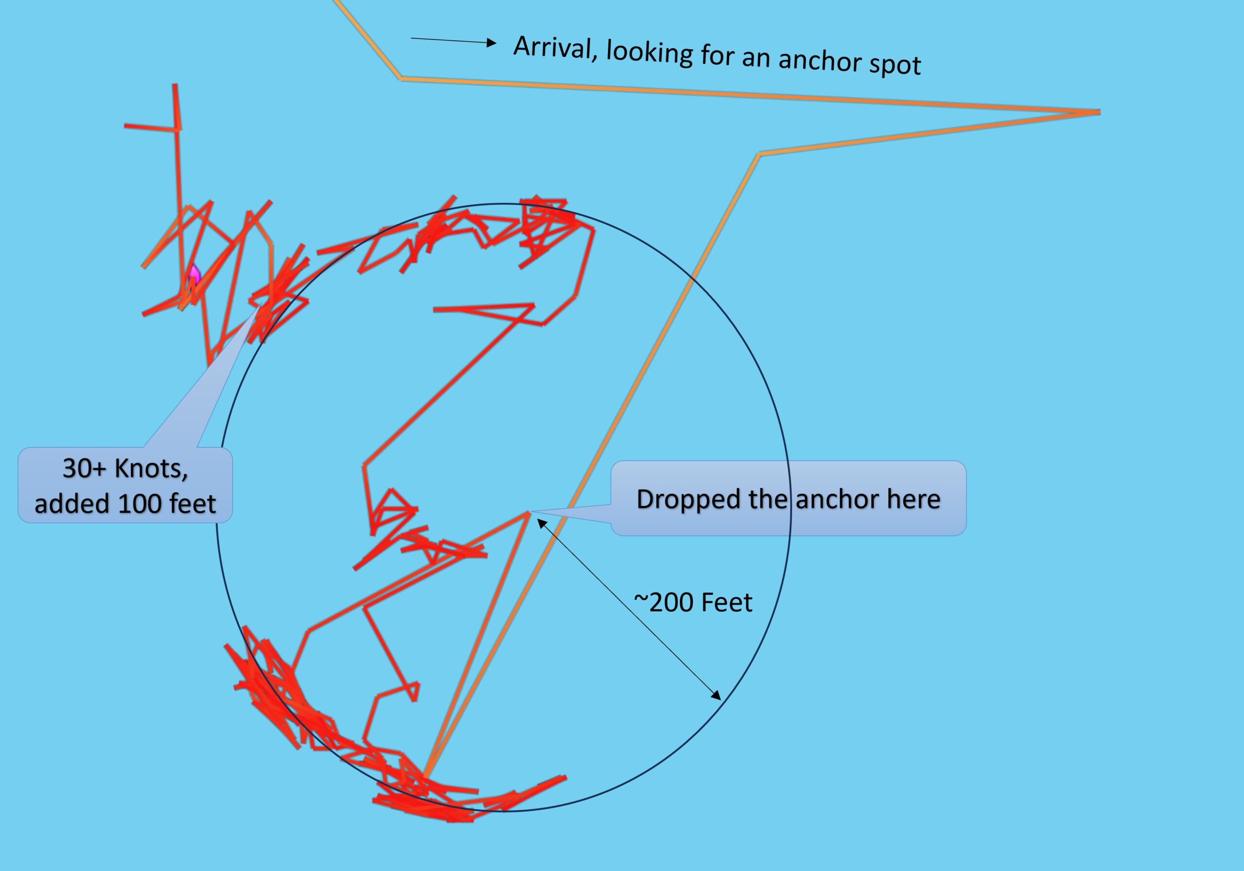
I made it to the anchorage in Hillsborough around noon on Thursday, and the predicted storm-force (34Kts) winds were expected to arrive sometime in the night. Because Tropical Storm Bret was passing to the north, the regular trade winds are, at first, sucked into the storm, causing a period of no wind, then they are augmented as the centre passes to the north and west.
I held anchor watch overnight, but nothing untoward happened. The winds remained light but shifted, as can be seen in the anchoring chart above. But in the early morning hours, the winds picked up within a very short period. We had long periods of over 30-knot winds in the anchorage and much stronger gusts. One of those tore away a solar panel on the dodger, and that took some bimini hardware along with it. So, while the winds were howling, I was out there with Paracord, effecting temporary repairs. Mark on Sea Life dragged a bit and used a calm period to re-anchor.
Then, in the early afternoon, the storm winds abated quickly, and only overcast scudding clouds remained to tell the tale of tropical storm Bret.